It has been a while since my last post but since I am now embarking on a new project for my Interactive Exhibit Design Class, it is time to start blogging again. In this class, we have to create an interactive exhibit for which I have a number of ideas. I hope to use the model I built last semester and put it to good use. Here are some pictures of the final result.
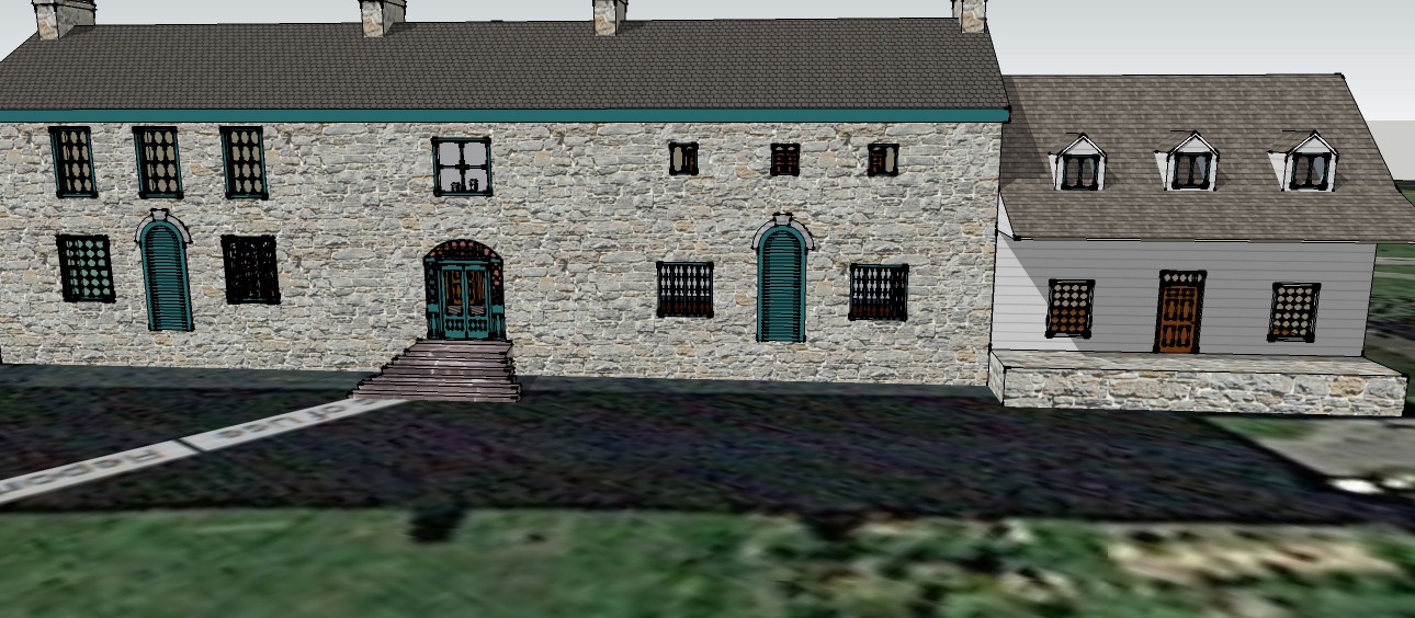
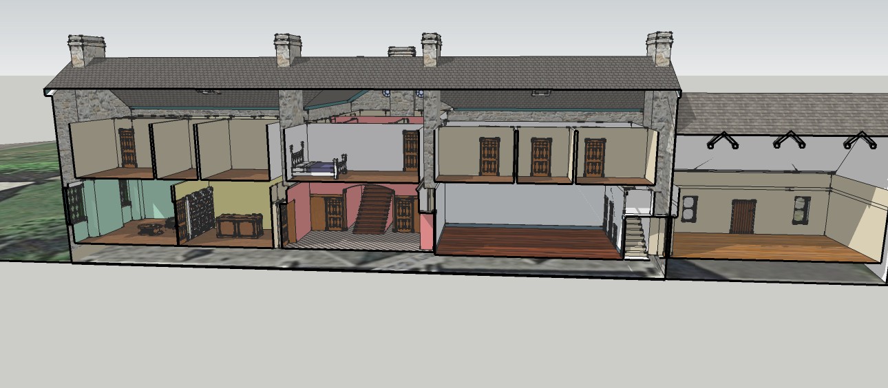
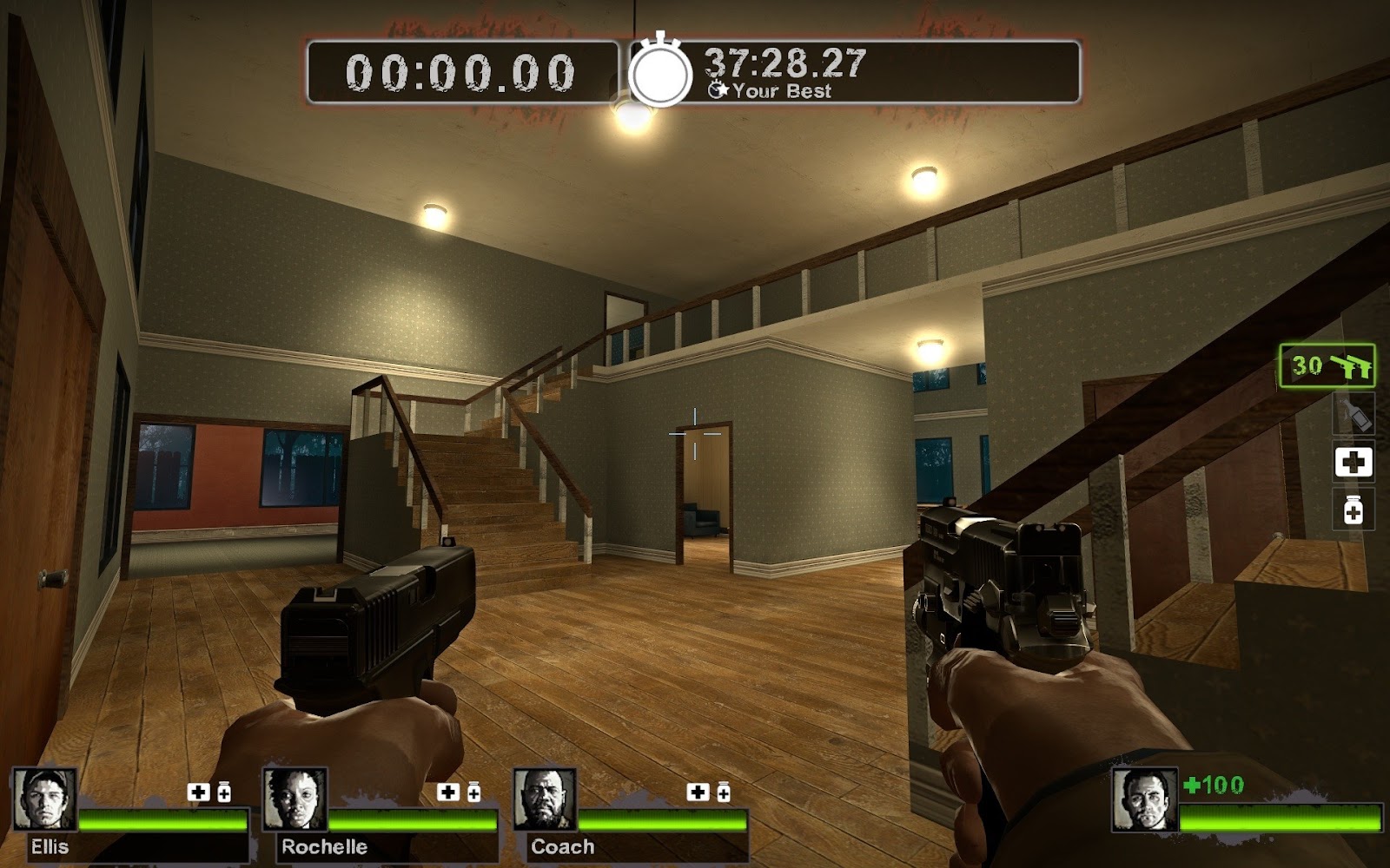
Building on my last post and the SketchUp model of Pinhey's Point I made last semester, I would like to make a video game level, such as Left 4 Dead. I mentioned in my last post that I hoped to achieve this during the Christmas break. Unfortunately, that did not happen as I was rendered computerless over the holidays and the process seems to be more trouble than I originally thought. Hopefully, my model is compatible with Valve Hammer Editor (the program used to create custom level maps), but this will require some testing. My goal when making the model originally was to have a digital version of the house that people could explore when the museum is closed or when accessibility is an issue. Making the house into a Left 4 Dead map seems to be the easiest was to make the model fully explorable in first-person view. Shooting zombies is just a bonus and might be an interesting Halloween activity.
My next idea for an interactive exhibit is taking historypin and geocaching and combining them. Geocaching is an activity where participants find caches using a GPS or mobile device to help them navigate. There are geocaches all over the world and it is easy to start hiding and seeking by downloading a geocaching app onto your phone. Historypin is a website that allows users to pin historic photographs to their modern locations. Images are pinned to their Streetview equivalent and a fade filter is used to toggle between modern Streetview and the historic image. They also have an app that allows people to explore the area themselves (although it didn't work for me when I downloaded it) and hold the historic picture up to the actual building.
By combining these two activities, I hope to develop a fun game that visitors to museums, especially historic houses, can do while they visit the museum. The activity would start with a hunt for the exact location the historic picture was taken. It is fairly easy to upload geocaches to the geocache website for others to find. Once the location is found, the cache would include a reproduction of the historic picture or a QR code that could lead them to a website with the historic picture. The cache/website would also contain some interpretive material about the history of the house and metadata about the image.
Unfortunately, this might be difficult to demonstrate at the end of the term since it is an activity that requires space. I would probably have to confine myself to Lawson Hall and may need to use pictures that are less than historical to prove the concept.
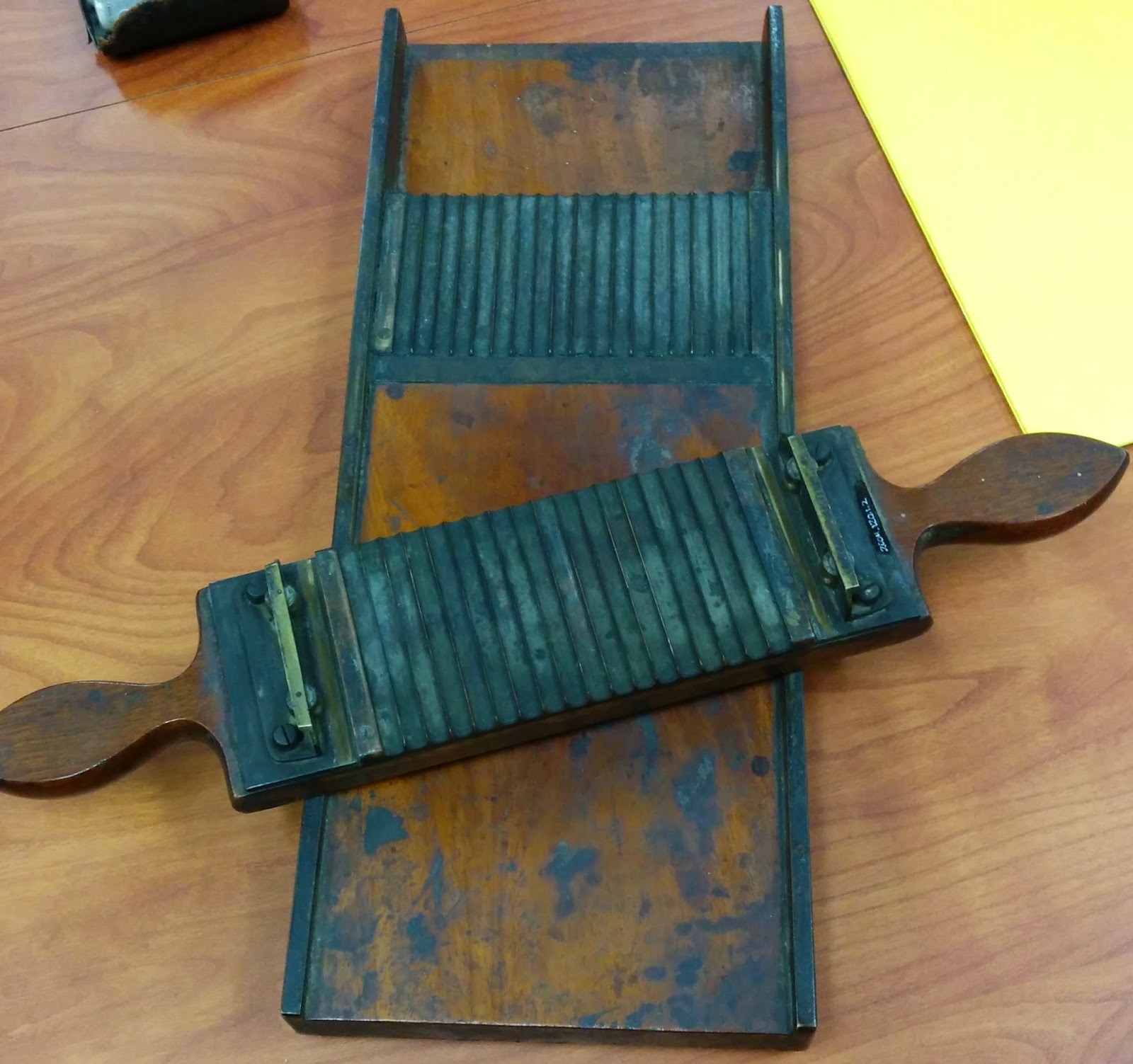
Finally, my last interactive exhibit design idea is to incorporate QR codes into the exhibit that the Museology class is developing. These QR codes would lead to supplementary information such as a YouTube video demonstration of how a pill cutter (which we intend to exhibit) was used (see here). It is a simple idea but it will hopefully enhance our exhibit and make it more engaging for viewers.